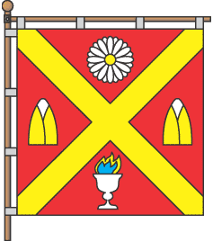
Alternate Names: (Ukrainian: Андрушівка, Russian: Андрушевка) is a city in Zhytomyr Oblast. 2001 population is 9,890. Andrushivka during WWII. Holocaust memorial: A Memorial has been erected in the town of Andrushivka (Zhytomyr region) in memory of the 252 Jewish women and 25 children shot by the Nazis on 19 August 1941. map. [August 2009]
TWO MASS GRAVES: Well maintained by local authorities. one is in the southeastern part of town near the hospital and the other close to an important road, Andrushivka-Pavelky Road. Each is surrounded by a fence, but neither has a gate. Each has a sign mentioning the Holocaust. Few people visit the never vandalized sites. Authorities have cleared vegetation and reerected stones at both. Now, local individuals do clearing and cleaning. [January 2009]
Photos [January 2016]
ANDRUSHEVKA I: US Commission No. UA05440101
Alternate names: Andrushovka (Yiddish), Andruszowka (German) and Andrusovka (Russian). Andrushevka is located in Zhitomirskaya, 47km from Zhitomir. Cemetery: Shevchenko Lane, N part of town. Present town population is 5,001-25,000 with 11-100 Jews.
- Town: Town Council of Ryabchuk Pavel [ph: (04136) 22090] and [ph: (04136) 21606].
- Town: Lomberg Mikhail Iosifovich of Andrushovka, Sverdlova St., 18 [ph: (04136) 22339].
- Caretaker: Voyevoda Zinaida Yakovlyevna of Shevchenko Lane, 13 [ph: (04136) 22530].
The earliest known Jewish community was 1784. 1926 Jewish population (census) was 655. The Jewish cemetery was established in the 19th century with last known Hasidic Jewish burial in 1994. No other towns or villages used this unlandmarked cemetery. The isolated, urban, flat land with no sign or marker. Reached by turning directly off a public road, access is open to all via a continuous fence with a non-locking gate. 21 to 100 stones, all in original location with none toppled or broken, date from 1920. The cemetery has no special sections. Some tombstones have portraits and/or metal fences around graves. The cemetery contains no known mass graves. The municipality owns the property used for Jewish cemetery only. Adjacent properties are residential and railroad. The cemetery boundaries are smaller now than 1939 because of railroad. Rarely, private Jewish or non-Jewish visitors and local residents visit. No vandalism is reported in last ten years or occasionally in the last 10 years. Local/municipal authorities and Jewish individuals within country cleared vegetation and fixed wall in 1980. Now, there is occasional clearing or cleaning by individuals. Within the limits of the cemetery are no structures. Vegetation overgrowth is a seasonal problem preventing access. Moderate threats: pollution and vandalism. Slight threats: uncontrolled access, weather erosion, vegetation, and proposed nearby development.
Documentation: Archive SW of Russia part V, t.2. Kogan Leonid of Novograd-Volynskiy, Lenina St. 107, apt.42. [Ph: (04141) 54259] visited site, completed survey, and interviewed Lomberg Mikhail Iosifovich of Sverdlova St., 18 and Voevoda Zinaida Yakovlyevna of Shevchenko St., 13 on 18/07/1995.
ANDRUSHEVKA II: US Commission No. UA05440501
The 1941 unlandmarked mass grave for Hasidim is located at right from road Andrushevka-Pavelki. The isolated wooded flat land has signs or plaques in local language mentioning the Holocaust. Reached by turning directly off a public road, access is open to all via a continuous fence with no gate. The approximate size is now 0.01 hectares. 1-20 stones, all in original location and none removed, date from 1946. Some tombstones have traces of painting on their surfaces and/or metal fences around graves. The municipality owns the property used for mass burial site. Adjacent properties are forest on road to Pavelky. The mass grave boundaries are larger now than 1939. Rarely, private Jewish or non-Jewish visitors and local residents visit. This mass grave was not vandalized. In 1946, local/municipal authorities erected stones and cleared vegetation. Now, there is occasional clearing or cleaning by individuals. Within the limits of the mass grave are no structures. Moderate threat: vegetation. Slight threat: uncontrolled access, weather erosion, pollution, vandalism and proposed nearby development. No threat: existing nearby development.
Documentation is unknown to surveyor. Kogan Leonid of Novograd-Volynskiy, Lenina St. 107, apt.42. [Ph: (04141) 54259] visited site on 18/07/1995 and interviewed Lomberg Mikhail Iosifoch on 18/07/1995. He completed survey on 10/08/1995.
ANDRUSHEVKA III: US Commission No. UA05440502
The 1941unlandmarked mass grave of Hasidim is located at SE part of town, 500 m from hospital. The isolated wooded suburban flat land has signs or plaques in local language mentioning the Holocaust. Reached by crossing other public forest, access is open to all via continuous fence with no gate. 1-20 stones, all in original location with none toppled or broken, date from 1946. No stones were removed. Some tombstones have traces of painting on their surfaces and/or metal fences around graves. The municipality owns the property only used for mass burial site. Adjacent properties are residential and forest. The mass grave boundaries are larger now than 1939. Rarely, private Jewish or non-Jewish visitors and local residents visit. This mass grave was not vandalized. Local/municipal authorities re-erected stones and cleared vegetation. Now, there is occasional clearing or cleaning by individuals. Within the limits of the mass grave are no structures. Moderate threats: uncontrolled access, pollution, vegetation and vandalism. Slight threats: weather erosion and proposed nearby development.
Kogan Leonid of Novograd-Volynskiy, Lenina St. 107, apt.42. [Ph: (04141) 54259] visited site on 18/07/1995 and interviewed Lomberg Mikhail Iosifovich. He completed survey on 10/08/1995.
