
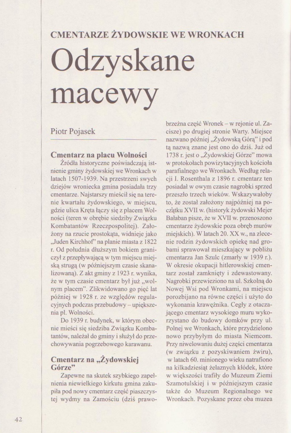
Alternate names: Wronki [Pol], Wronke [Ger]. 52°43' N, 16°24' E, 32 miles NW of Poznań (Posen). Jewish population: 569 (in 1890).
Słownik Geograficzny Królestwa Polskiego (1880-1902), XIV, pp. 52-53: "Wronki". Wronke [Ger].
The town in the Szamotuły powiat in Greater Poland Voivodeship in western-central Poland since 1999, previously in Piła Voivodeship (1975-1998) close to the Warta River to the NW of Poznań with a population of approximately 11,000. In 1920 of a 1,000 year-old synagogue was discovered. This evidences a thriving Jewish commercial settlement in Poland a generation before the arrival of Christianity. Some of the earliest Polish coins are many bearing Hebrew inscriptions showing that Jews had obtained the royal franchise for operating the country's mint. [July 2009]
CEMETERY:
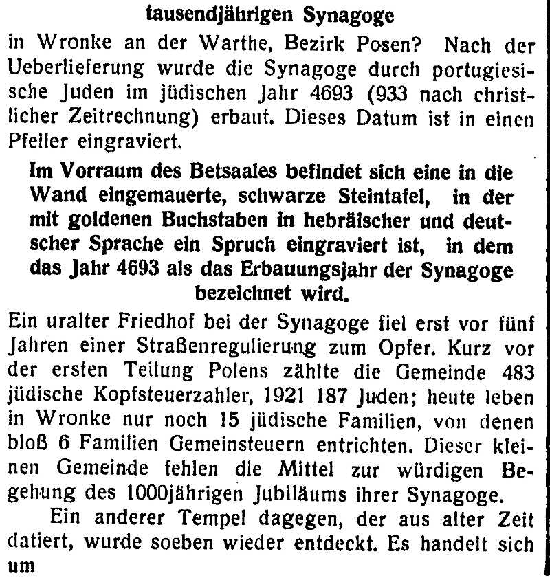
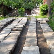
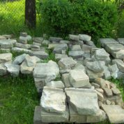
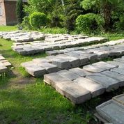
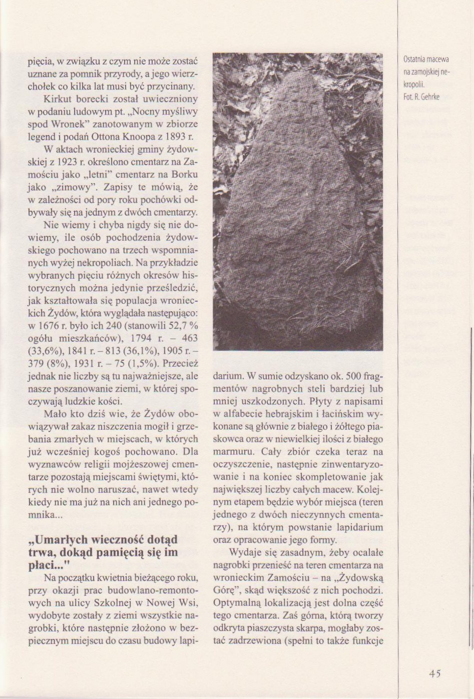
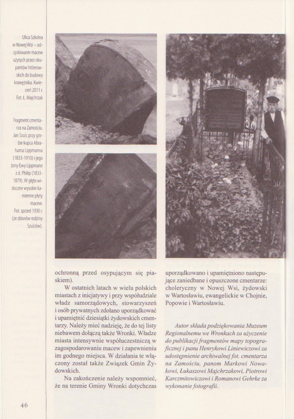
Lapidarium. During WWII. the Nazis destroyed the two Jewish cemeteries and transported the gravestones to Nowa Wieś (outside Wronki) where they were cut into equal parts for curbstones on Szkolna street. In 2011 about 500 gravestone fragments were rediscovered and stored on private ground in Nowa Wieś (see photos). This is the biggest number of rediscovered Jewish gravstones in Poland. In 2012 the city and community of Wronki determined to take appropriate action to build a lapidarium, convey communal land, coordinate tasks, construct, and handle official documentation of the lapidarium in the future. [May 2013]
Lapidarium information on Facebook. [July 2013]
Matzevot From Wronki And A Collection Of Stone Monuments. 27 May 2013 - "The first stage of documentation works of discovered matzevos which were found in one of the nearby towns has come to an end. Seven hundred and forty headstones or their fragments have been photographed, and personal data of the deceased have been registered. This is the result of the work done by Ofra Reisenfeld and her students from the Section of Hebrew, Aramaic and Karaim Studies at Adam Mickiewicz University of Poznań, as well as by Daniel Kwaśniewski and Piotro Pojasek, a local history expert from the Museum in Wronki. / Inmates from the penalty institution in Wronki helped in manual works. The project enjoys the patronage of Robert Doran, an assistant of the Mayor of Wronki Town and Municipality." Read the original article here. [Apr 2-14]
WRONKI I: US Commission No. POCE000430
Town is located in Pila province at 52º43' N º16º23ºE, 40km from Poznan. Present population is 5,000-25,000 with no Jews.
The cemetery is on ul. Kreta.
- Town: Urzad Miasta, Wronki,
- Local: Mgr. Roman Chwaliszezshi, wojerzosdsui, Konserwator Zabythow, 64-920 Pila, m. Terezenska 1, Tel. 223.88.
- Regional: Paristoza Sluzba Ochrony Zabytkow, aadzial w Pile, Mgr. Barbara Luczynska; adres j.w. cemetery. Mgr. Marek Fijakalski, Museum Okregone, 64-920 Pila ul. Chopina 1, Tel. 271-37.
This community dates from the 13th century, one of the oldest in Poland. They received the privilege to build a synagogue in 1528, then burnt at the turn of the 16th century to the 17th. In 1607, Zofia Czarnowska gave permission to build a masonry synagogue, which was destroyed in 1940. The cemetery was established close to the synagogue in 1607. No other community used this Progressive cemetery reached by turning directly off a public road, with no wall or gate. The isolated urban flat land has no sign or marker. Its size was 0.10 ha before WW2 and was liquidated in 1928. There are no gravestones or known mass graves. The municipality owns property is use for recreation. Adjacent areas are residential. The cemetery was vandalized before WW2.
Henryk Grecki, 70-534 Szecin, ul. Sottysia 3/13, tel. 377-41 completed survey on 30 Aug 1991. Documentation: sources from Mr. Fijalkowski.
WRONKI II: US Commission No. POCE000431
The unlandmarked cemetery is located in the district called Zamosc on Szcize Street, 1 km from Wronki.. No other community was using this Progressive cemetery. The isolated suburban hillside has no sign or marker. Reached by turning directly off a public road, access is open to all with no wall, or gate. Its size before WW2 and now is 1.68 ha. No gravestones remain. Stones were used in building foundations. The municipality owns site used for agricultural use and waste dumping and partially built up. Adjacent property is agricultural, residential, and forest. Size is smaller due to housing development [sic: contradicts previous] The cemetery was vandalized during WW2. There is no maintenance or cemetery structures, only residential housing within the limits of the cemetery. Vandalism and incompatible development are very serious threats.
Henryk Grecki, 70-534 Szecin, ul. Sottysia 3/13, tel. 377-41 completed survey on 30 Aug 1991 using sources from Mr. Fijaikorski.
UPDATE: The original synagogue was built in the year 933 [?], according to an article published in Die Stimme, 2 June 1932. Thanks to This email address is being protected from spambots. You need JavaScript enabled to view it. for this information, a copy of Die Stimme of the above date, and the photographs below. [May 2013]
This email address is being protected from spambots. You need JavaScript enabled to view it.t also has in his possession a book written by the former Mayor Ottensen in 1907 about the history of Wronke .On the first page he tells about the founding the synagogue in 1905 and the German translation of the hebrew Inscription which is "Zum ewigen Andenken haben wir die Überlieferung,das dieses Gotteshaus erbaut wurde im Jahre 4693 nach dem die Welt erschaffen wurde". English translation:" For eternal memory we have the story that this House of God was build in the Year 4693 after the World was created." [June 2013]
Pictures below courtesy This email address is being protected from spambots. You need JavaScript enabled to view it. [July 2013]

UPDATE: Crowd-sourcing Jewish matzevah monument [Oct 2014]