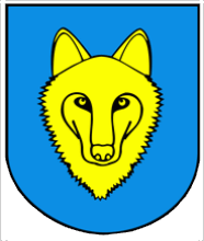
 Alternate names: Wilczyn [Pol]. 52°29' N, 18°10' E, 50 miles N of Kalisz, 19 miles N of Konin. 1900 Jewish population: about 100. Słownik Geograficzny Królestwa Polskiego (1880-1902), XIII, p. 461: "Wilczyn". Wilczyn is a village in Konin County, Greater Poland Voivodeship in west-central Poland is the seat of the administrative district called Gmina Wilczyn, 31 km (19 mi) N of Konin and 86 km (53 mi) E of the regional capital Poznań. The village has a population of 1,200. Gmina Wilczyn contains the villages and settlements of Biela, Cegielnia, Dębówiec, Dębówiec-Towarzystwo, Głęboczek, Gogolina, Góry, Kaliska, Kopydłówek, Kopydłowo, Kościeszki, Kownaty, Kownaty-Kolonia, Maślaki, Mrówki, Nowa Gogolina, Nowy Świat, Ościsłowo, Ostrówek, Suchary, Świętne, Wacławowo, Wilczogóra, Wilczyn, Wiśniewa, Wturek, Wygorzele and Zygmuntowo. [July 2009]
US Commission No. POCE000711
Alternate Yiddish name: Winchol. The town is located region Koninskie at 52º2918º10, 30 km from Konin in. Cemetery: N of Cegielinska Street. Present town population is 1,204 with no Jews.
- Local: Wojt [head of a village] Grazyna Smigiel, Urzad Gminy Wilczyn, ul. Koninska 4.
- Regional: [see: Skulsk] mgr. Irena Sobiersjska PSOZ Konin, Posiedno, tel. 975 w 212-936.
The earliest known Jewish community dates from the 17th century. The Jewish population before WWII was 250. Korn, owner of a mill. and the family Markowski, merchants, lived here. The last known Orthodox Jewish burial was 1939. The Jewish community was Orthodox up to WW I and Progressive/Reform after WW I. The unlandmarked, isolated, suburban agricultural crown of a hill has no sign or marker. Reached by turning directly off a public road, access is open to all with no wall, fence, or gate. The pre-WWII cemetery size was 0.5 ha. The boundaries are smaller, reduced by agriculture. No stones are visible. The municipality and a private individual own the property used for agricultural purposes. Adjacent property is agricultural and residential. The cemetery area is partly cultivated and partly dug out for illegal waste dumping. Another part is probably under a one-family housing complex. Rarely, local residents visit. It was vandalized during World War II with no maintenance or care. Within the limits of the cemetery are no structures. Security and weather erosion are very serious threats; and vandalism is serious.
Lucja Pawlicka Nowak, 62-510 Konin, ul. Listopeido 15/76 (difficult to read) completed survey on 20 November 1992 using interviews and documentation at PSOZ-Konin. Other documentation exists. He visited the cemetery on 15 August and 20 November 1992 and interviewed Irena Wieczorek, ul. Strzelinska 15, 62-550 Wilczyn.
