 Alternate names: Rabka [Pol], Rabka-Zdrój. 49°37' N, 19°57' E, 32 miles S of Kraków, 10 miles NNW of Nowy Targ. Renamed Rabka-Zdrój in 1999. Jewish population: 48 (in 1880), 172 (in 1921). Słownik Geograficzny Królestwa Polskiego (1880-1902), IX, pp. 343-347: "Rabka". Rabka-Zdrój, usually referred to as Rabka, is a spa town in Lesser Poland Voivodeship with a 2004 population of 19,018 is in the southern part of Poland between Kraków and Zakopane. Rabka lies on the northern slopes of the Gorce mountains where the rivers Poniczanka and Sionka join the river Raba. [June 2009]
US Commission No. POCE0000755
Rabka is located in voivodship of Nowy Sacz at 49º37N º19.57E, 64 km. from Krokow, 18 km. from Nowy Targ, and 66 km. from Nowy Soyer. Cemetery is on Slonecsna Street in the young forest. Present population is 5,000-25,000 with no Jews.
- Local: [Mayor] Burmistrz, Urzad Miasti I Gminy, ul. Orkana 35, 34-410 Rabka, tel. 766 16.
- Regional: [see: Bobowa] Wojewdozki Konserwator Zabytkow, mgr., Zygmunt Lewcruk, ul. Kilinokiego 68, 33-300 Nowy Soyer, tel. 238-38 wcw 234.
1921 Orthodox and Progressive/Reform Jewish population was 172. No other towns or villages used this cemetery. The isolated suburban hillside has a sign or marker in Hebrew and local language mentioning the Holocaust. Reached by turning directly off a public road, access is open to all with a continuous fence with non-locking gate. The cemetery is 0.1 ha. No stones are visible. OR The granite, sandstone, and concrete have Hebrew and Polish inscriptions. [sic] The cemetery contains special memorial monuments to Holocaust victims. The cemetery contains marked and unmarked mass graves. The property used as a Jewish cemetery only. Adjacent property is a young forest. Rarely, local residents and private visitors stop. It was vandalized during World War II. Local/municipal authorities and the Sisters Peller Private Foundation cleared vegetation, fixed wall, and fixed gate in 1989. No care. Within the limits of the cemetery are no structures. Security (uncontrolled access) is a moderate threat. Weather erosion and vandalism is a slight threat. Vegetation is a serious threat. Greenery is breaking the concrete slabs.
Pietr Antoniak, ul. Dobra 5m36, 05-800 Pruszkow [see: Bobowa] completed survey on September 5, 1992 and visited the site on August 22, 1992.
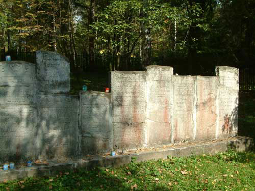
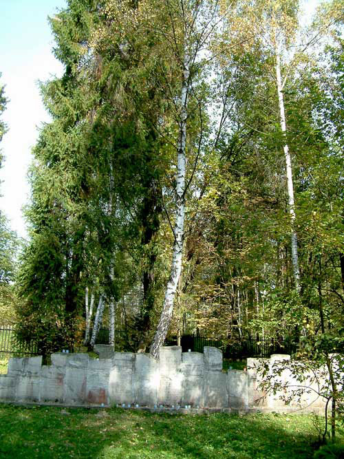
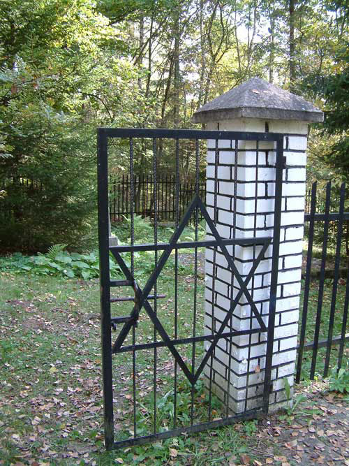
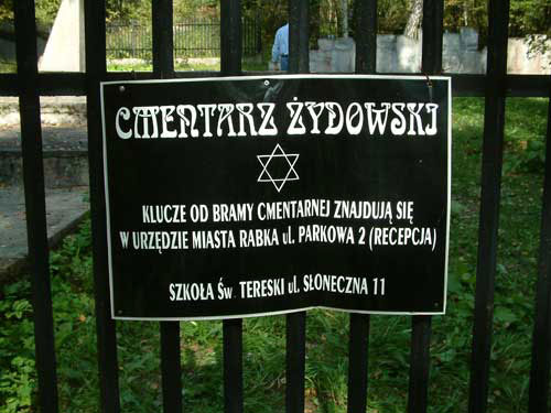
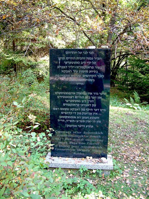
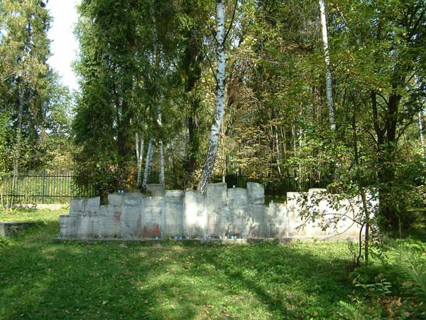
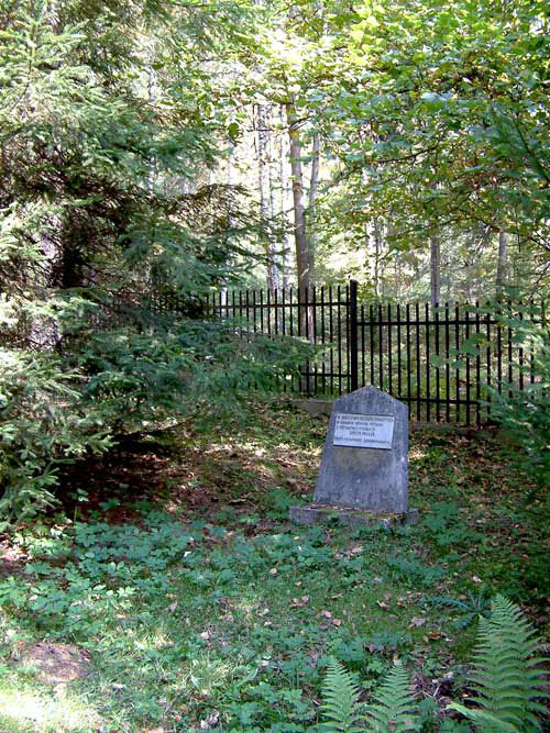
[UPDATE] Photos by Charles Burns [April 2016]