Staryy Sambor and Старый Самбор [Rus], Stary Sambor [Pol], Altshtat [Yid], Ir Yashan and סטארי-סאמבור [Heb], Alt Stat [Ger], Staremiasto [Pol], Staryy Sambirand Старий Самбір [Ukr], Staryi Sambir, Staryj Sambir, Stari Sambor. 49°26' N, 23°00' E, 53 miles WSW of Lviv (Lwów), 26 miles SSE of Przemyśl (Pshemishl).1890 Jewish population. 1,613.
- Encyclopedia of Jewish Life (2001), p. 1238: "Stary Sambor".
- Pinkas HaKehilot, Poland, Vol. 2 (1980), p. 378-379: "Stary Sambor"
- Shtetl Finder (1980), p. 2: "Altshtat, Ir Yashan".https://www.facebook.com/events/1178925222208009/?active_tab=about
- Słownik Geograficzny Królestwa Polskiego (1880-1902), XI, pp. 237-241: "Staremiasto".
- Jewish Records Indexing Poland Town Page
- Museum of the History of Polish Jews
- Galicia SIG
- Jewish Records Indexing - Poland
photos. [December 2012]
Sefer Sambor-Stary Sambor; pirkei edut ve-zikaron le-kehilot Sambor-Stary Sambor mi-reshitan ve-ad hurbananSAMBOR I: US Commission No. UA13250101
http://www.hotsoftline.com/news2.htm [July 2001]
http://www.jewishgen.org/yizkor/sambor/Sam258.html [July 2001]
The cemetery is located at the center of the town, at the left of the synagogue. Sambor is 73 km from L'vov. Present town population is 5,001-25,000 with fewer than 10 Jews.
- Town officials: Town State Dept., Chairman Kot M.I. [Phone: (03236)33103]. Main architect of town, Medvedyk B.M. [Phone: 34514]. Town State Department.
- Others: State Archives of L'vovskaya Oblast.
The earliest known Jewish Community was 1447. 1939 Jewish population was 6068. The last known Zhidachevsky Hasidic burial was in 1943. The isolated urban flat land has no sign or marker or the marker mentions the Holocaust. Reached by turning directly off a public road, access is open to all. A broken masonry wall, non-locking gate, and a broken fence surround the unlandmarked cemetery. The approximate size of cemetery before WWII and now is 1.50 hectares. No stones are visible. Location of any removed stones is unknown. The cemetery contains marked mass graves. Municipality owns site used for Jewish cemetery and agricultural use (crops or animal grazing.) Properties adjacent are commercial or industrial and residential. The cemetery boundaries are unchanged since 1939. Occasionally, organized Jewish group tours or pilgrimage groups, organized individual tours, private visitors and local residents visit. The cemetery was vandalized during World War II and occasionally in the last ten years. Jewish groups within country and abroad fixed wall and fixed gate in 1992. There is no maintenance. Within the limits of the cemetery are no structures. Very serious threat: uncontrolled access (The tombstones are under the grown, on the cemetery graze cattle.) and vandalism. Moderate threat: pollution. Slight threat: vegetation (seasonal.)
Gel'ston, I.I. of a/c 10569, L'vov 290049 [Phone: (0322) 227490] visited and completed survey on /09/96 and 10/10/96. No interviews.
SAMBOR II: US Commission No. UA13250102
See SAMBOR I for town information. The unlandmarked cemetery is located at the center of the town, in schoolyard. Living here were R' Iosif-Moshe Kharif and R' Aaron Levin. Buried here are R' Itshak and Yakov Azenberg, R' Rappoport, and Tsadik Uri Yules. The last known " Tsvi-Girsh from Zhidachev Hasidic" burial was 1758. The isolated urban flat land by water has no sign or marker. Reached by turning directly off a public road, access is open to all. A continuous fence and a gate that does not lock surround the cemetery. The approximate size of cemetery before WWII was 0.35 hectares. No stones are visible. Location of any removed stones is unknown. The cemetery has only common tombstones. The cemetery contains no known mass graves. Municipality owns site used for schoolyard. Properties adjacent are residential. The cemetery boundaries are smaller now than 1939 because of housing development and commercial or industrial development. The cemetery was vandalized during World War II and not in the last ten years. There is no maintenance. Within the limits of the cemetery is the school. Very serious threat: uncontrolled access and vandalism (exposed to arbitrary excavations.) Moderate threat: pollution. Gel'ston I.I. of a/c10569, L'vov 290049 [Phone: (0322) 227490] visited and completed survey on /08/96 and 10/10/96. No interviews. Documentation: Evreyskaya entsiclopediya , Brokgauz and Efron; Doerflerowa 'Materialy do Historij m. Sambora-1390-1795', Lwow, 1936. The map of town 1849, 1854.
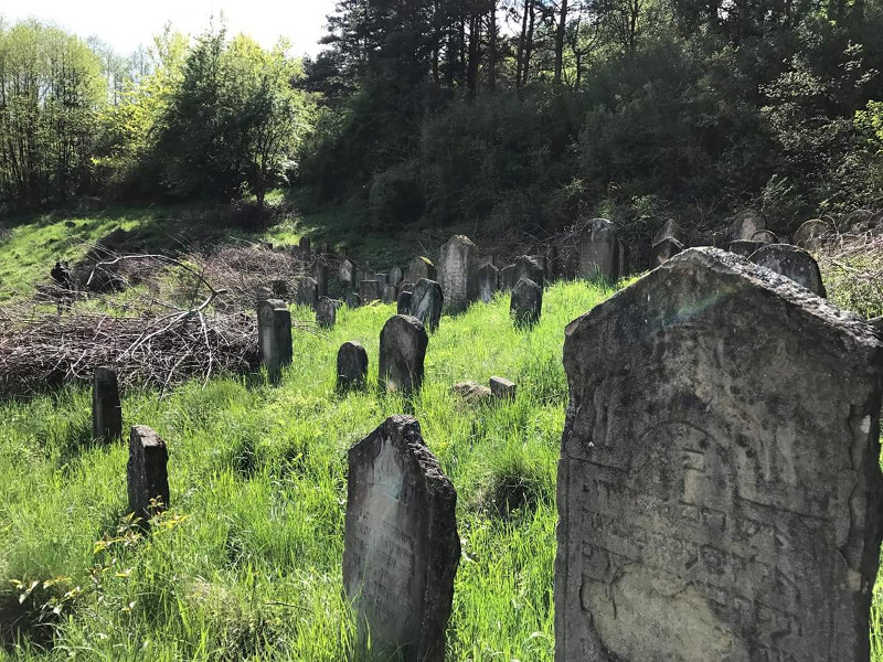
[UPDATE] Photos by Charles Burns [April 2016]
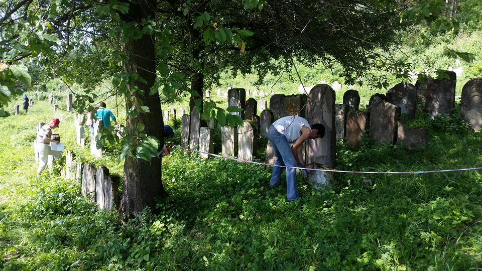
[UPDATE] Six-day summer work camp to clean up synagogue cemetery [Facebook, August 2017]
[UPDATE] Photo from Facebook [August 2017]