Alternate names: Koprod (Yiddish), Copaigorod (Polish), Kopaigorod (Russian) and Kopai Gorod (Ukraine). Kopaygorod is located in Vinnitskaya at 48º52 27º47, 62 km from Vinnititsa. The cemetery is located at western suburb, on the road to Murovannie Kurilovtsa. Present town population is 1,000-5,000 with fewer than 10 Jews.
- Town officials: Barski Town Executive Council - Deputy Chairman [Phone: -4341].
- Regional: Barski Regional Executive Council - Deputy Chairman [Phone: (04341) 2463]. Vinnitska Oblast Council of Melnick Nikola Evtykhovich [Phone: (0432) 327540].
- Vinnitska Oblast Jewish Community - Gybenko Bella Aronova [Phone: (0432) 351666].
- Others: Vinnitska Oblast Cultural Society - ILchyk Nikola Nikolayevich [Phone: (0432) 325637].
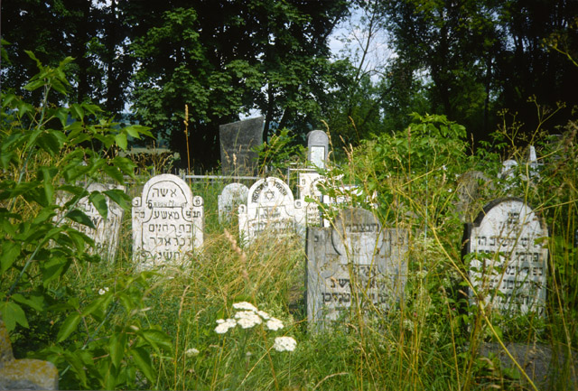
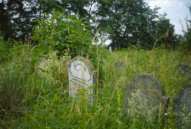
The earliest known Jewish community was 1600. 1939 Jewish population (census) was 5000. Effecting the Jewish Community were Khmelnitsky pogroms 1648-9, Barsky Confederation pogrom 1768-72, pogroms during the 1918-21 Civil War, and 1941-44 Ghetto. According to legend, the "Tsadik Malka" is buried in the unlandmarked Hasidic cemetery. The isolated suburban agricultural hillside has no sign or marker. Reached by turning directly off a public road, access is open to all. A broken fence and non-locking gate surrounds the site. 101 to 500 common tombstones, about half in original location and between 25%-50% toppled or broken, date from 18th to 19th century. Location of any removed tombstones is unknown. The cemetery has special sections for men, women and Cohanim. The cemetery contains no known mass graves. The municipality owns the property used for Jewish cemetery and waste dumping. Adjacent properties are agricultural and residential. The cemetery boundaries are smaller now than 1939 because of housing development and agriculture. Rarely, local residents visit. The cemetery was vandalized during World War II and frequently in the last ten years. There is no maintenance. Within the limits of the cemetery are no structures. Overgrowth or trees covers almost entire area of the cemetery. Vegetation overgrowth is a constant problem, disturbing stones. Buildings constantly encroach and encircle the cemetery. Water drainage at the cemetery is a seasonal problem. Very serious threat: uncontrolled access and vegetation Serious threat: vandalism. Moderate threat: weather erosion, pollution, existing nearby development and proposed nearby development.
Vladimir Oks of Varienskaya 17D Apt. 52 Odessa 270065 [Phone: (0482)] visited site and completed survey on 23/06/1994. Interviews are not listed. Documentation: Town populations of the Russian Empire, Podol region, 1864; Historical Monuments of the Kamenets Podol region , V.P. Gulman, 1901; Population of towns in the Podol region , A. Krylov, 1905; National Minorities of Ukraine, Register of villages, Kharkiv, 1925. Other documentation exsits but inaccessible.
KOPAYGOROD II: US Commission No. UA01190102
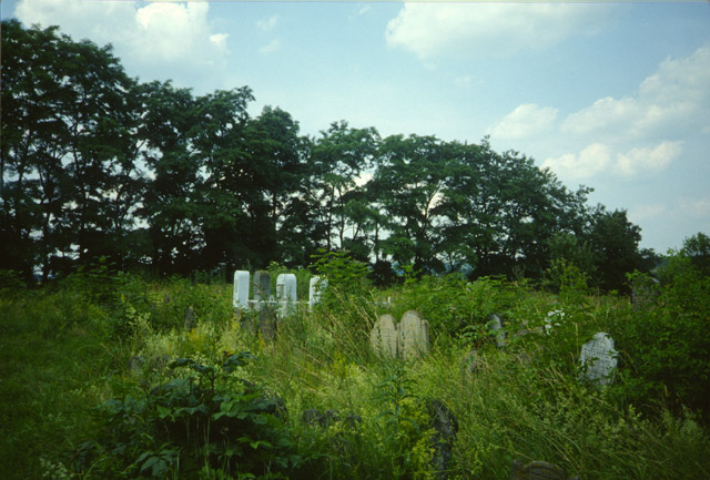
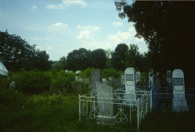
The cemetery is located at 3 km from the town-on right of the road to Bar near railway station. The Jewish cemetery was established in the 19th century with last known Hasidic burial in 1994. No other towns or villages used this unlandmarked cemetery. The isolated suburban agricultural flat land has no sign or marker. Reached by turning directly off a public road, access is open to all. A continuous fence with non-locking gate surrounds site. 501 to 5000 stones, most in original location with less than 25% of surviving stones toppled or broken, date from 19 to 20th century. Location of any removed tombstones is unknown. The cemetery has special sections for men, women, Cohanim and children. Some tombstones have traces of painting on their surfaces, iron decorations or lettering, other metallic elements, portraits on stones, and/or metal fences around graves. The cemetery contains unmarked mass graves. The municipality owns the site used for Jewish cemetery only. Adjacent properties are agricultural and residential. The cemetery boundaries are unchanged since 1939. Occasionally, organized individual tours and Jewish or non-Jewish private visitors stop. The cemetery was vandalized during World War II and occasionally in the last ten years. Jewish individuals within country and abroad did re-erection of stones, patched broken stones, cleaned stones and cleared vegetation 1945-1948. Now, occasionally, individuals clean or clear. Within the limits of the cemetery are no structures. End 19th to early 20th century, overgrown trees destroyed graves and headstones. Vegetation overgrowth is a constant problem, disturbing graves. Water drainage at the cemetery is a seasonal problem. Serious threat: vegetation. Moderate threat: uncontrolled access and vandalism. Slight threat: weather erosion, pollution, existing nearby development and proposed nearby development.
Oks Vladimir Moiseevich of 270065, Oddesa, Varnenskaya Street 17D, Apt. 52 [Phone: (0482) 665950] visited site and completed survey on 6/23/94. Interviewed was local resident. Documentation: Town populations of the Russian Empire. Podol Region.1864; Historical Monuments in the Podol-Kamanets Region. V.P.Gylman 1901; Population of towns in the Podol Region. A. Krylov. 1905; National Minorities in Ukraine. Register. Kharkiv 1925. Other documentation exsits but inaccessible.
Photos courtesy This email address is being protected from spambots. You need JavaScript enabled to view it., July 2011