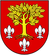
 Alternate names: Poddębice [Pol], Podembitza, פודדמביצה [Yid], Poddembitze, Поддембице [Rus], Podembice, Wandalenbrück [Ger, 1943-45]. 51°53' N, 18°57' E, 24 miles WNW of Łódź, 17 miles SW of Łęczyca (Lintshitz). 1900 Jewish population: 1,333. Pinkas ha-kehilot; entsiklopediya shel ha-yishuvim le-min hivasdam ve-ad le-aher shoat milhemet ha-olam ha-sheniya: Poland vol. 1: The communities of Lodz and its region (Jerusalem, 1976). Poddębice powiat is a unit of territorial administration and local government in Łódź Voivodeship, central Poland since January 1, 1999 with its administrative seat and largest town in Poddębice, 37 km (23 mi) W of the regional capital Łódź. The only other town in the county is Uniejów, 14 km (9 mi) NW of Poddębice. 2006 population is 42,195, out of which the population of Poddębice is 7,875, that of Uniejów is 2,916. Gmina Poddebice, apart from the town of Poddębice, contains the villages and settlements of Adamów, Antonina, Bałdrzychów, Balin, Bliźnia, Borzewisko, Busina, Chropy, Chropy-Kolonia, Dominikowice, Dzierzązna, Ewelinów, Feliksów, Gibaszew, Golice, Góra Bałdrzychowska, Góra Bałdrzychowska-Kolonia, Grocholice, Jabłonka, Józefów, Józefów-Kolonia, Kałów, Karnice, Klementów, Kobylniki, Krępa, Ksawercin, Leśnik, Łężki, Lipki, Lipnica, Lubiszewice, Małe, Malenie, Niemysłów, Niewiesz, Niewiesz-Kolonia, Nowa Wieś, Nowy Pudłów, Panaszew, Podgórcze, Porczyny, Praga, Pudłówek, Rąkczyn, Sempółki, Stary Pudłów, Sworawa, Szarów, Tarnowa, Tumusin, Wilczków, Wólka and Zagórzyce. Movie. [June 2009]
US Commission No. POCE000689
Poddebice is located in the Sieradz region at 51º53N 18º57E, about 37 km from Lodz. The cemetery is located on Lodzka Street. Present town population is 5,000-25,000 with no Jews.
- Town: Poddebice is Urzad Miasta i Gminy, ul. Todzka 17, 99-200 Poddebice, tel. 78-25-80.
- Regional: Wojewodzki Konserwator Zabytkow, ul. Kol?? 3; 98-200 Sieradz, tel. 849-3815. Urzad Wojewodzki w Sieradzu, Plac Wojewodzki 3; 98-200 Sievadz, tel. 849-71666.
- Interested: Tydowski Instytut Historyczny w Polsce; ul. Tlomackie 315; 09-090 Warszawa; tel. 27-92-21.
The earliest known Jewish community was 18th or 19th century. 1921 Jewish population was 1,333, 42.3%. The landmarked Orthodox and Conservative Jewish cemetery was established in the 19th century with last known Jewish burial in 1942. The suburban flat land, separate but near other cemeteries, has no sign or marker, no wall, gate, or fence. Reached by turning directly off a public road, access is open to all. The present size of the cemetery is about 1.5 hectares (the same as before W.W.II.) 1-20 gravestones, all in original location, date from 1934. Removed stones are located in a museum in Poddebice. The granite, limestone, and sandstone rough stones or boulders, finely smoothed and inscribed stones, or flat stones with carved relief decorations have Hebrew inscriptions. The cemetery contains no known mass graves. Municipality owns site used as a Jewish cemetery. Properties adjacent are commercial. Organized Jewish group tours/pilgrimage groups, organized individual tours, private Jewish and non-Jewish visitors, and local residents occasionally visit. The cemetery was vandalized during W.W.II, but not in the last ten years. No maintenance. Properties adjacent used for storage and waste dumping/agriculture are a very serious threat. There are also serious security, weather erosion, and pollution threats, and moderate threats from vandalism and vegetation.
Adam Penkalla, deceased, who also visited the cemetery, completed survey in November 1992 using private documentation.
